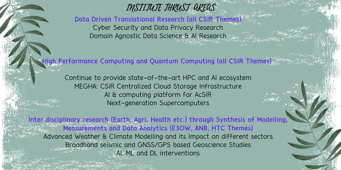


The Interdisciplinary Data Research Division (IDRD) focuses on inter disciplinary data and physics driven research currently in the areas of Earth Science, Agriculture, Healthcare etc. through Synthesis of Modelling, Measurements and Data Analytics. In Earth Science, CSIR-4PI is recognised as a leader at national level and competing at international level for its Niche and multi-dimensional high impact studies of the earth system covering all the four geographic spheres for over three decades. CSIR-4PI pioneered in Global Positioning System (GPS) based geo-science research in India since 1994, when GPS was made fully operational. We were the first to give neo-deterministic seismic hazard map for Indian Sub-continent. Forecasting of high impact hydro-meteorological disasters in the context of urbanization and land use change is an important activity at CSIR-4PI. Another impactful activity is the study of various aspects of climate change using mathematical modelling, data analytics, space-based geodesy etc. and its impact on rainfall, agriculture and health hazards specific to Indian sub-continent. Understanding different factors influencing the variation in the Indian Summer Monsoon and quantifying them is an active area of research of the institute. Studies on carbon cycle in ocean, atmosphere and land adds one more dimension in the context of the Paris climate agreement by providing robust carbon flux estimates that can help addressing gaps in atmospheric carbon cycle research. Most of these studies are carried out through close collaboration with National and State disaster management agencies and supported by highly sophisticated observational infrastructure of the Institute such as GNSS network, broadband seismic network, GHG observation network (WMO standard) being operated in collaboration with several research and academic institutes across the county for past three decades. In fact, the institute established IGS (International GNSS Service) station at Bangalore in 1994 which serves as a reference station for all the geoscience research in the country.
सीएसआईआर चौथा प्रतिमान संस्थान
CSIR Fourth Paradigm Institute
वैज्ञानिक एवं औद्योगिक अनुसंधान परिषद (सीएसआईआर) की एक घटक प्रयोगशाला ।
A constituent laboratory of Council of Scientific & Industrial Research (CSIR).
Welcome to Fourth Paradigm Institute
फोर्थ पैराडाइम इंस्टीट्यूट में आपका स्वागत है।
Select your Preferred Language to Enter the Website
वेबसाइट में प्रवेश करने के लिए अपनी पसंदीदा भाषा चुनें।